Plantation Key seawall repair planning
Identify the specific canal treatment system, current bottom habitat, and Islamorada jurisdiction before proposing wall or overwater changes.
Describe your project on this page ↓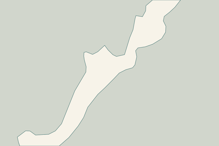
Get to know your waterfront
Plantation Key has multiple canal-restoration approaches, not one island-wide treatment system. Village records describe backfilling at canal 116 and gravity-well projects at canals 114 and 132. They also document ecological recovery in one restored canal. For a waterfront owner, those details support two early questions: which system serves this exact canal, and what is present on the bottom beside the proposed work today?
About Islamorada: municipal boundaries · Village weekly update, December 6, 2024 · Village weekly update, July 26, 2024 · Canal 132 well project: addendum 1, August 14, 2024 · Resolution 25-11-109: Canal 114 well repair
Check the canal system and living bottom together
Plantation Key falls within Islamorada, even when an address is commonly described using a nearby postal place name. Start with the Village’s planning and building review, then identify the canal beside the property. The island’s different restoration projects should not be blended into a single history. About Islamorada: municipal boundaries
Canal 116 is a useful example of why an old description of a bare or poor-quality bottom can become outdated. The Village documented backfilling in January 2024 and later reported vegetation and coral observations. That record is a reason to obtain appropriate current environmental information for proposed work, not proof that identical habitat exists beside every Plantation Key wall. Village weekly update, December 6, 2024
Other canals have different infrastructure. Before arranging equipment access or bottom disturbance, ask whether a gravity well, associated pipes, or monitoring locations could be affected. Request the actual location and responsible maintenance contact rather than assuming that a feature visible on another canal serves yours. Village weekly update, July 26, 2024 Resolution 25-11-109: Canal 114 well repair
For the private wall, have the assessor document structural condition independently of water quality. The scope should identify the proposed disturbance footprint, protection of existing equipment, and the party responsible for complying with environmental permit conditions. Public-contract monitoring arrangements can illustrate the questions to ask, but your project must follow its own approvals. Canal 132 well project: addendum 1, August 14, 2024
What could the work cost?
A Plantation Key estimate may need current ecological information, underwater measurements, and protection of canal-treatment infrastructure as well as structural work. Ask which of those items are included. Compare proposals using the same disturbance footprint and access assumptions, and keep ongoing public canal-system maintenance separate from the private repair price.
Published Florida starting ranges, with the source area shown. Your Key Largo project needs a site-specific written quote.
Compare quotes and plan a budget →Find the relevant permits and records
| Starting point | What to resolve | Prepare and look up |
|---|---|---|
Islamorada, Village of Islands Building / Planning | Confirm the parcel, complete marine scope and local review route. | Bring the survey, existing permits, proposed drawings and access plan. |
Islamorada planning and biology review | Discuss benthic documentation and shoreline habitat. | Identify existing versus expanded work and request project-specific guidance. |
Environmental and federal review | Resolve in-water work, habitat, submerged lands and sanctuary requirements. | Use one complete scope to confirm the DEP, Corps and sanctuary authorizations that apply. |
Identify the restoration system and habitat
Use these local records to prepare a property-specific discussion with your designer and the responsible authority.
Start with Islamorada
Confirm the parcel and proposed scope with Village staff; all of Plantation Key is within the municipality.
Identify the exact restoration history
Distinguish canal 116 backfill from the separate gravity-well records for canals 114 and 132.
Village weekly update, December 6, 2024 · Village weekly update, July 26, 2024 · Resolution 25-11-109: Canal 114 well repair
Update the environmental information
Ask what current bottom survey and equipment-protection plan the proposed work requires. Do not rely solely on a historic canal assessment.
Village weekly update, December 6, 2024 · Canal 132 well project: addendum 1, August 14, 2024
Prepare your Plantation Key project
Start with the address, visible changes and records you have. Separate observations from questions that need a site assessment.
Start with your concern. We’ll help you find a clear next step for your seawall.
Plantation Key project questions
Does Monroe County handle a Plantation Key permit because the address says Tavernier?
Plantation Key is within Islamorada. Confirm the parcel with Village staff and follow the applicable Village review path; the postal place name does not change the municipal boundary.
Can I assume a restored Plantation Key canal has no sensitive bottom habitat?
No. The Village reported vegetation and coral observations after work at canal 116. Obtain current information for the proposed disturbance area rather than relying on an old canal description.
Do canals 114, 116, and 132 use the same restoration method?
The cited records describe backfilling at canal 116 and gravity-well work at canals 114 and 132. Ask for the records and equipment layout for your exact canal.
Village weekly update, December 6, 2024 · Village weekly update, July 26, 2024 · Resolution 25-11-109: Canal 114 well repair
Keep planning
Nearby waterfront guides
Show sourcesHide sources
- About Islamorada: municipal boundariesSource reviewed 2026-10-25
- Village weekly update, December 6, 2024Source reviewed 2026-10-25
- Village weekly update, July 26, 2024Source reviewed 2026-10-25
- Canal 132 well project: addendum 1, August 14, 2024Source reviewed 2026-10-25
- Resolution 25-11-109: Canal 114 well repairSource reviewed 2026-10-25
- Islamorada Building ServicesSource reviewed 2026-10-25
- Islamorada Village BiologistSource reviewed 2026-10-25
- DEP Southeast District Marathon branchSource reviewed 2026-10-25
- Florida Keys sanctuary nearshore constructionSource reviewed 2026-10-25